Parklands Albury Wodonga acknowledge the Duduroa-speaking people as the Traditional Custodians of the land now known as Castle Creek Conservation Reserve.
This reserve is comprised of three Wodonga Retained Environment Network (WREN) parcels of land with high floristic value. Although all quite different in their structure and quality, together they form a significant habitat area, particularly when combined with the adjoining private land which cannot be further developed under the current local government planning schemes.
Size
54 hectares
Vegetation community
Grassy Woodland, Floodplain Riparian Woodland, Valley Grassy Woodland Mosaic
Features
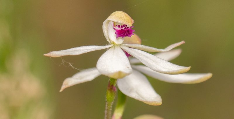
High native biodiversity, scenic, bird watching
Classification
High conservation value and passive recreation
Maps:
- Go to Walking Maps for an Interactive Map
- Download seasonal Nature Trail Notes – Castle Creek in Autumn
- Download general Trail Notes – Castle Creek Conservation Reserve
Downloadable Track Map:

Background
WREN reserves provide a vital base for maintaining our unique local ecosystem functions, and protecting habitats along with the plants and animals that are ‘doing it tough’ as our urban areas grow. Our reserves also create important opportunities for plant genes and more mobile species to move through the landscape. This ability for species to move is of increasing importance as the weather variations associated with climate change are realised.
Wodonga has led the way by establishing a network of protected bush reserves across its municipality. In 2006, the Wodonga Retained Environment Network Strategy was prepared by the Albury Wodonga Development Corporation in partnership with Wodonga Council and the Department of Environment and Primary Industries (DEPI).
The WREN Strategy set out to ensure that the predicted urban spread into the areas that are situated southeast of Wodonga (Leneva and Baranduda) occurs in an environmentally sound manner. That is, in a way that protects the existing bush areas and their biodiversity (plants, animals and genes), while ensuring development is of a sustainable design.
The Strategy highlighted numerous parcels of bushland of varying value and sought to select some of the best areas to secure as bush reserves, and to protect and manage their important values in perpetuity via legislation. These reserves would also help to offset some of the losses of native vegetation that were expected to happen with urban development in the lower value developable areas of Leneva and Baranduda. In February 2013, the WRENs Strategy was updated to the Leneva Valley and Baranduda Native Vegetation Precinct Plan (NVPP) and the reserves were incorporated into Wodonga Council’s Planning Scheme.
There is now a network of reserves across southeast Wodonga that are often referred to as WRENs Reserves. There are two agencies involved in the management of WRENs reserves, those being Wodonga Council and Parklands Albury Wodonga. Parklands currently have six reserves in the Leneva/Baranduda area that they are responsible for. For further information on these areas, see the information/map attached.
The activities that are permitted in WRENs Reserves are limited to those which do not pose a threat to the values that these reserves are designed to protect. Walking on trails and other passive recreational activities such as bird watching, on leash dog walking or nature walks are all permitted. Activities that are strictly prohibited include firewood collection, vehicle use including trail bikes and any activity that may cause damage to soil, native vegetation, or reserve infrastructure.
As with management of any parcel of land, a lot of work goes into managing this network of high conservation value WRENs Reserves. Parklands Albury Wodonga run occasional events in these reserves and are always on the lookout for keen volunteers to come out and help partner with us to undertake WRENs activities. Options for volunteers include tree planting, nestbox monitoring, checking reptile monitoring stations, fencing and fence repairs, and weed control days. Anyone interested in volunteering their time to get to know more about our great local reserves should contact Parklands Albury Wodonga.
Things to do:
- Birdwatching
- Observing Nature
- Picnicking
- Short walks
- Mountain Biking
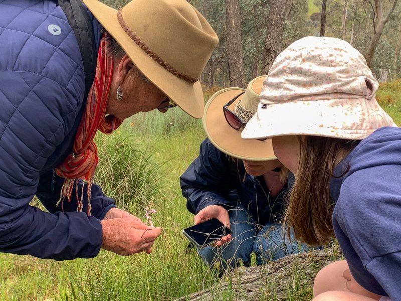
- Citizen Science
- On-leash Dog Walking
- Scenic Views
- Photography
Access
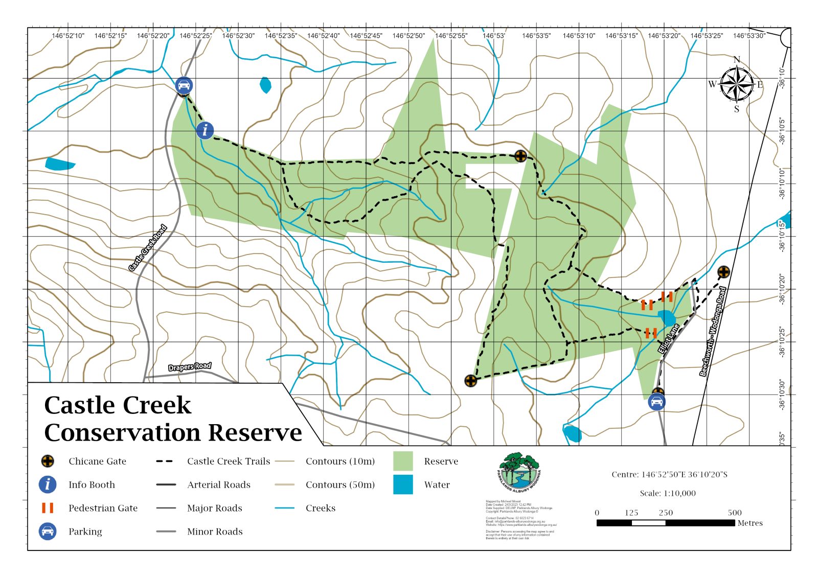
Pedestrian chicane gate on Castle Creek Road, Elliott Lane (off Drapers Road) and Beechworth Road.
Facilities
- Walking Tracks
- Informal carparking on Castle Creek Road and Elliott Lane
Want to get involved? We’re always looking for volunteers and people with unique skills to help out whenever possible. Click the link below to find out more!


