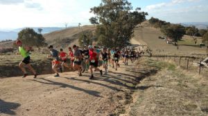
The rolling hills of the 238 hectare Huon Hill bush park in Wodonga feature some great walking trails in open woodland.
Stunning panoramas overlook Albury and Wodonga, with views of Lake Hume, Mt. Bogong, Mt. Feathertop, the Kiewa Valley, Bonegilla, Baranduda Range, Table Top Mountain and the Murray Valley towards Corowa.
Huon Hill rises to 428 metres above sea-level, and be warned: it is very steep in places! There are several trail options including less steep circuits, and your reward is in the incredible views:
- Stringybark Track (2km)
- Summit Track (200 metres)
- Bundy track (3km)
- Sheoke track (2.5km)
- Mistletoe Track (2km)
Please follow the link to our map and Nature Trail Notes to get the best out of this bush park experience: https://www.parklands-alburywodonga.org.au/support-your-parks/publications/201511137494.asp
We would love to receive the Strava data of your favourite routes on Huon Hill. We are looking for Strava maps, elevation profiles and kml files for all of the walks around Albury Wodonga so that these can be shared on our website and on popular Apps such as AllTrails, enabling people to download maps onto their mobile phones or plan their walks / rides via the internet.
Please send files and photos to us at info@parklands-alburywodonga.org.au


